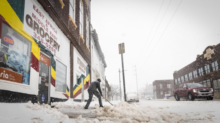
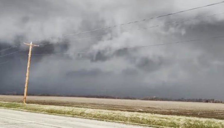
Spring is off to a furious start for several parts of the country after a blizzard dumped over a foot of snow and tornadoes raced through neighborhoods in the Midwest as the same storm system moves east to drench the East Coast.
Tens of millions of people woke up to damage in the Midwest on Thursday morning, the first official day of spring.
Blizzard warnings stretched from Kansas to Minnesota on Wednesday, creating dangerous whiteout conditions that led to semis' being overturned on roadways.
Nebraska authorities warned locals to stay off the roads after snow and blowing wind closed roads, downed power lines, caused car accidents and led a trooper to warn: "Go home and stay home. This storm is the worse one of the season."
Top snow totals from the blizzard include 14.5 inches reported in Lakota, Iowa; 12 inches in Algona, Iowa, and Waco, Nebraska; and 10 inches in Gove City, Kansas.

Meanwhile, possible tornadoes ripped roofs off buildings in Gary, Indiana, on Wednesday.
Gary Mayor Eddie Melton said dozens of people were displaced after a tornado touched down Wednesday night. A person who was trapped in debris when the roof of her house collapsed was rescued and taken to a hospital, where she was stable. Everyone else was accounted for, and there were no reports of missing people, officials said at a news conference Thursday.
Eight tornadoes were reported in north-central Illinois, and additional straight-line windstorm damage was reported near Chicago and Indianapolis.
In Texas, powerful winds created a windstorm that blocked the sun as nearby Southern states grappled with wildfires fueled by strong winds.
Fierce winds in the storms include 91 mph winds in Three Rivers; New Mexico, 81 mph in Lipscomb, Texas; 68 mph in Garden City, Kansas; 66 mph in Davenport, Iowa; and 60 mph in Tulsa, Oklahoma.
Winds posed a fire risk in some Southern states.
In Arkansas, firefighters were battling 38 wildfires in the state. In Florida, crews continued to fight a wildfire in southwest Miami-Dade County that shut down access in and out of the Florida Keys. That brushfire had grown to 22,000 acres and was just 20% contained, according to the Florida Forest Service.

A red flag warning was in effect for much of southern Florida from 11 a.m. to 8 p.m. Thursday because of low humidity and southwesterly wind gusts, which meant fires could develop and spread rapidly.
On Thursday morning, 10 million people remained under winter weather advisories and warnings. In the morning, rain and snow was expected to hit the Great Lakes region.
Airports from the Great Lakes to the mid-Atlantic are likely to be affected by windy conditions, along with rain and snow, with Chicago; Detroit; Buffalo, New York; Washington; Philadelphia; and Raleigh, North Carolina, most likely to experience.
In the afternoon into the evening, heavy rain will drench the I-94 corridor.
Fire danger continued with 15 million people under fire alerts Thursday morning across two areas: the western high Plains and eastern Florida.
Cites under a critical fire risk Thursday included Roswell, New Mexico, to Amarillo, Texas, for the western area and Orlando, Florida, to Miami for the eastern area.
Come Friday, winter’s last gasp will bring wet snow for northern New England and cold winds for much of the Northeast as the system pushes off the United States.
