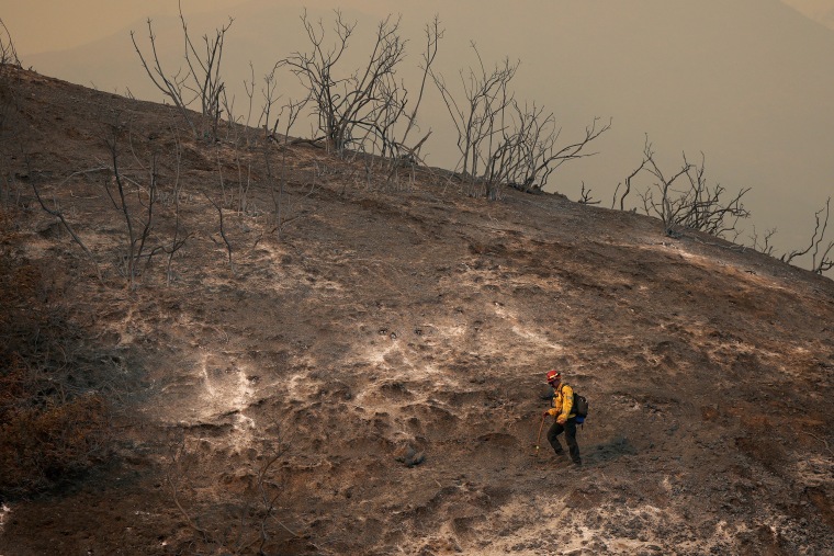
After weeks of dry weather that contributed to the spread of historic and deadly wildfires in the Los Angeles area, Southern California is finally getting some rain.
A slow-moving low-pressure system was expected to linger over the Southwest, bring showers through the early work week and help end Southern California's lingering wildfires and one of the driest stretches of weather in the region's recorded history.
Los Angeles has had only 0.03 inches of rain since Oct. 1 — 5 inches behind the average — making this the driest season to date. By morning, an additional 0.34 inches had been recorded at Los Angeles International Airport, with a flood watch in effect for much of the city through Monday afternoon.
The National Weather Service said burn scars from recent and past fires are areas of concern, as the rain could trigger flash flooding, debris flows, mud flows and mudslides. As much as 1.5 to 2 inches of rain was possible in Los Angeles-area fire zones, forecasters said.

The Los Angeles Fire Department reported Sunday afternoon that a small debris flow in the coast-abutting Santa Ynez Canyon of the Palisades Fire burn area was moving toward the sea.
Deadly wildfires in Southern California, including the Palisades, Eaton, Hughes and Border 2 fires, were still technically active, with all but the Border 2 Fire showing nearly full containment Sunday, according to state fire officials.
As a fire precaution, officials closed Angeles National Forest, which occupies much of the land in the San Gabriel Mountains, through at least Saturday. Among the January fires that burned in Angeles National Forest parkland were the Eaton and Hughes fires, which state fire officials said were 98% and 95% contained, respectively, on Sunday.
Sunday’s rain in central and Southern California started with showers that got more intense through the afternoon.
Videos on social media showed cars driving through a downpour in the Hollywood Hills of Los Angeles. Another video showed rain falling in La Mesa, in San Diego County, as the person shooting the video cheered.
The heaviest rain in the region is expected overnight and will gradually lighten until it stops Monday afternoon.
San Diego continued the driest start to a water year in its recorded history, with the storm producing only 0.02 inches of rain Sunday afternoon but with expectations for more overnight. Weather service meteorologist Chandler Price said the next-driest start to a water year, which begins Oct. 1, was in 1963.
The system could bring Las Vegas’ first measurable rainfall since July, with rain expected Monday, National Weather Service meteorologist John Adair said.
If the rain holds off until then, Las Vegas will have hit 197 days without measurable precipitation — short of the record of 240 consecutive days of dry rain gauges, recorded on Dec. 16, 2020, the weather service office in Las Vegas has said.
Phoenix on Sunday was still awaiting rain that could end a streak of dry weather that began in August.
The system will move into Arizona on Monday, bringing the bulk of snow and rain showers east. Scattered rain showers will persist across Nevada and Arizona through Tuesday.
Winter weather alerts in Southwest, Midwest and Great Lakes region
Winter weather alerts are in effect for parts of California, Arizona and Nevada.
Snow totals in Southern California mountains through Monday will generally range from 2 to 10 inches, with localized amounts of 18 inches and more possible. It will also be very windy, with gusts up to 50 mph creating hazardous travel conditions.
More than a half of a foot of snow fell on Mount Baldy in the San Gabriel Mountains on Sunday, according to weather service data. It straddles the border between Los Angeles and San Bernardino counties.
Two inches of snow amassed in Wrightwood, also in the San Gabriels, and 4 inches accumulated in Snow Valley in the San Bernardino Mountains, the weather service said. Big Bear Mountain Resort, also in the San Bernardinos, reported 4 inches of fresh powder.
A 24-hour National Weather Service winter storm warning Sunday afternoon covers Mount Baldy, Wrightwood and the Angeles Crest Highway in the eastern San Gabriels and warns of up to 14 inches of snow, gusts of 35 mph and a snow level expected to dive to 3,000 feet overnight.
In Arizona's Yavapai County Mountains, a winter weather advisory will be in effect from 5 a.m. Monday local time through midnight, with the weather service forecasting snow totals of 1 to 3 inches and up to 6 inches at elevations above 6,000 feet.
Elsewhere in the country, lake effect snow warnings remain through Monday for northern New York, where the most persistent bands will produce 9 to 18 inches of snow.
In the Great Lakes region, wind alerts will be in effect through Monday for Illinois through New York — including the cities of Chicago, Milwaukee, Detroit, Buffalo and Rochester — with gusts that may exceed 40 mph to 60 mph.

