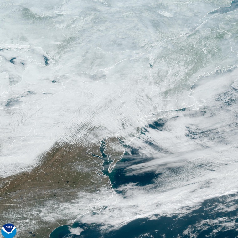
Two more storm systems are expected to hit the northern United States in succession this week, just as a different bout of severe weather across the Northeast begins to slow down.
The first of the upcoming systems will start from the Plains on Monday, creating snow in the north and heavy rains in the south. The heaviest snow is expected to hit Kansas, with a potential of 2 to 5 inches across the state.
On Tuesday, the storm system is predicted to expand east, infiltrating the Appalachian and mid-Atlantic regions, as well as extending a bit into the Northeast. Virginia; Washington, D.C.; Maryland; and Delaware are likely to get the most severe snow, with 3 to 6 inches expected.
The next storm system will follow soon after on Wednesday, casting another round of widespread rain and snow over the Plains and the Midwest before it moves into the Northeast on Wednesday night and into Thursday.

And throughout the week across the Plains and the Rockies, a blast of arctic air may drop temperatures up to 10 to 40 degrees below average.
Montana and the Dakotas are expected to face the worst of the shifts, with temperatures to stay below zero and wind chills to get as frigid as minus 40 degrees. Certain cities, including Seattle; Billings, Montana; and Portland, Oregon, could also experience record lows.
“If you’re hoping for a substantial warmup soon, you’ll be waiting for a bit longer. Arctic air will keep temperatures very cold through this week, and below normal temperatures are favored to continue through the third week of February,” the National Weather Service's Bismarck, North Dakota, office wrote on X.
The severe storm updates come as the National Weather Service celebrates its 155th birthday Sunday.
The weekend's low pressure-driven storm brought snow, freezing rain and icy conditions to the mid-Atlantic and the Northeast overnight after it moved west from the country's midsection.
New York City's Central Park was blanketed with a thin layer of snow that drew visitors who rode makeshift sleds down its gentle slopes and armed themselves with snowballs Sunday. The park was covered in about 3 inches of snow by late Sunday morning, according to NBC News meteorologists.
Ballston Spa, New York, in the state's Capital Region, recorded a whopping 14 inches of snow from the storm by late morning, network meteorologists said.
Overnight in Rockland County, New York, enough snow covered a roadway that lanes became an abstract concept and at least one SUV was seen spun out, video showed.
In East Petersburg, Pennsylvania, a man tested the fortitude of the morning's layer of ice on his driveway Sunday by sliding a hockey puck on it, video showed.
Residents of Freedom, New Hampshire, awoke to a fluffy blanket of fresh powder, video from the community shows. A National Weather Service-recognized weather station near Tamworth, New Hampshire, about 6 miles from Freedom, registered a 24-hour snow total of nearly 10 inches.
Boston Logan International Airport had logged 5.5 inches of snow in 24 hours by Sunday evening, according to weather service data. Fresh powder blanketed rooftops and snowflakes floated amid the cityscape Sunday.
The weather service office in Burlington, Vermont, said Sunday that Mount Mansfield, the state's highest peak, has gotten 78 inches of snow this season, nearly 2 feet above normal for this time of year.
The weekend storm wreaked havoc on terrestrial roadways and delayed travel in the skies.
An estimated 416 inbound and outbound U.S. flights, the vast majority in the Northeast, were canceled through early Sunday evening, according to the travel tracker FlightAware.com. Delays affected 3,245 domestic flights, it said.
The low pressure system was moving off the coast, and all winter alerts have been dropped in the Northeast, though residents may see some lingering snow showers Sunday night.
Over the next one to two weeks, forecasts from the National Oceanic and Atmospheric Administration predict temperatures will remain colder than usual across the northern United States.
